Resources
Youtube video How To Get Live Satellite Images Directly From Space by safeitforparts
- hf
- handheld radio (!) + WaveEditor on Android mobile
- antenna: rabbit ears dipole
- antenna: QFH
- sdr: RTL-SDR v3
- filter: SAWbird+ filter
- sdr software
- gqrx
- SDR++
- decoder software
- noaa-apt
- WXtoImg
- SatDump
- Raspberry Noaa v2
Online satellite prediction https://www.n2yo.com/
Online decoder https://apt.open-weather.community/
Experiment
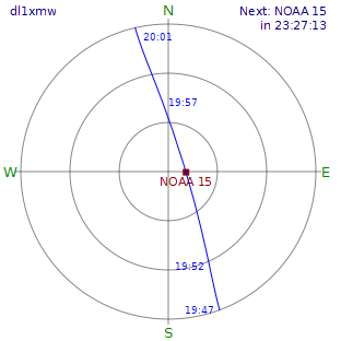
Satellite
- NOAA 15 going straight overhead 2023-07-29 17:50 UTC
Equipment
- ICom IC-705
w/ SD Card and buildin recorder
tuned 137.620MHz WFM - Arrow Antenna 146/437-10BP
2m only, duplexer - SatDump
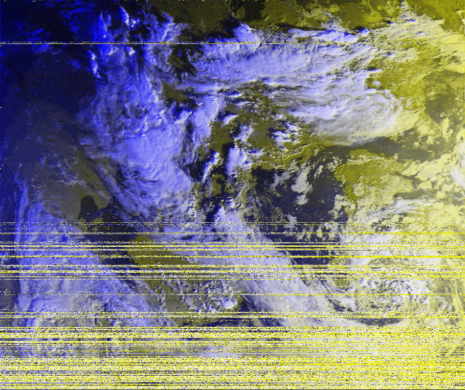
Result
Instand success. IC-705 w/ directional Antenna might be overkill. Manual checking the polarisation and satellite position degrades the image. Reception was quite good down to the horizon, but fluctuating due a metal construction over the nearby inner city highway.
Next goals:
- reduce interferance by just trackig the satellite
- use a LEO station w/ automatic tracking
- maybe use a QFH w/ SAWbird+ filter and Rasperrypi to grab automated